Nothing like tales of a lost island to get the imagination going. Today the Wikiworm’s weekly delve into the strangest articles on Wikipedia uncovers the story of a Mediterranean island that was mistakenly attacked by American war planes…
Ferdinandea is a submerged volcanic island which forms part of the underwater volcano Empedocles, 30 km (19 mi) south of Scicily, and which is one of a number of submarine volcanoes known as the Campi Flegrei del Mar di Sicilia. Currently a seamount, eruptions have raised it above sea level several times before erosion has caused it to submerge again.
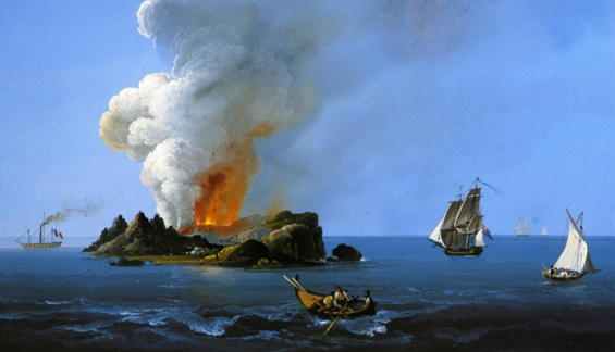
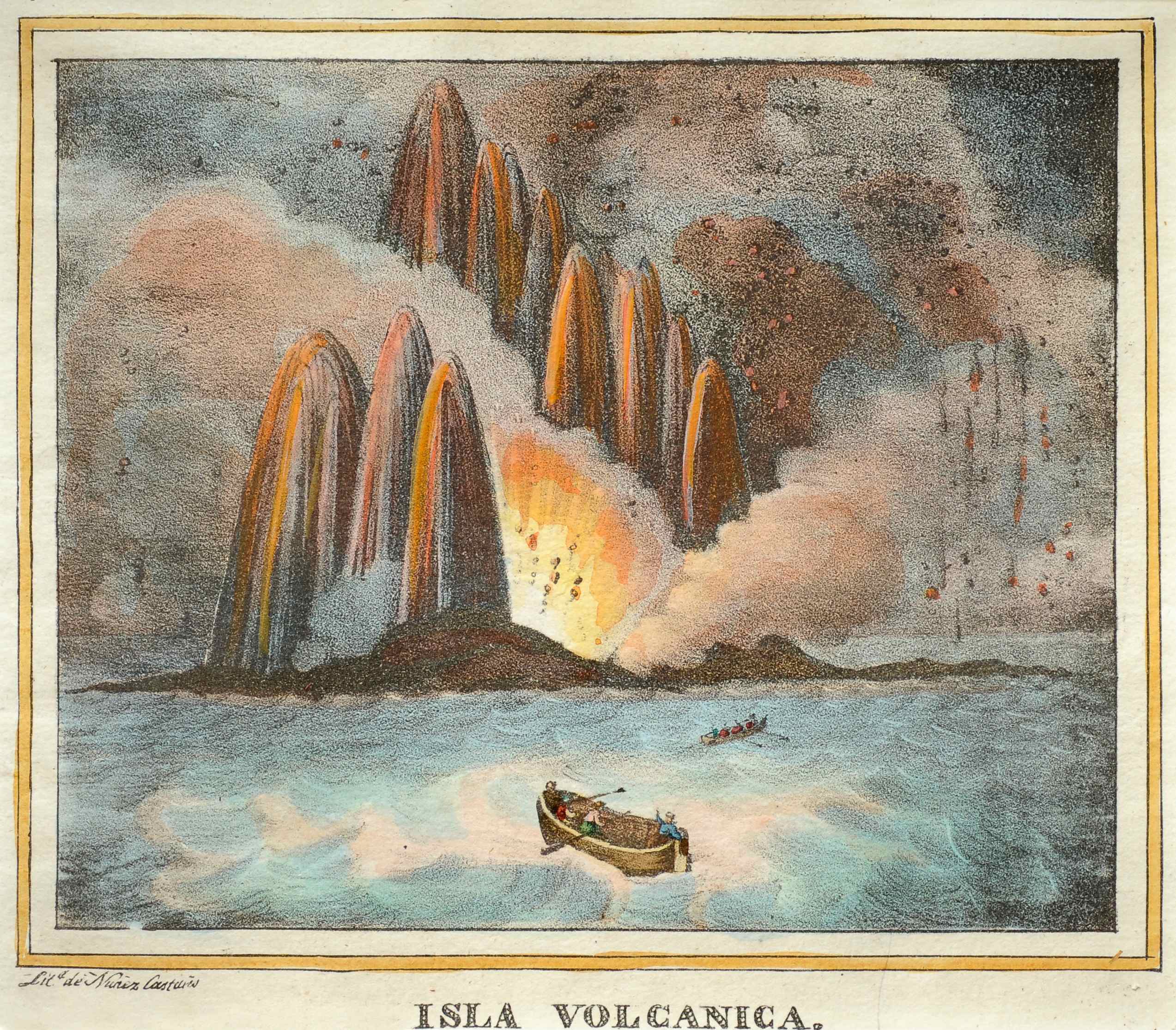
The island’s most recent appearance was in July 1831. On July 13th, a column of smoke was clearly seen rising from the sea. Sicilian islanders believed it to be a ferry on fire. On the same day, the brig Gustavo passed through the area, confirming a bubbling in the sea that the captain thought was a sea monster. Another ship reported dead fish floating in the water. By July 17, a fully grown islet had formed.
The eruptions of 1831 resulted in the island increasing in size to about 4 km (2.5 mi). However, it was composed of loose tephra, easily eroded by wave action, and when the eruptive episode ended it rapidly subsided, disappearing beneath the waves in January 1832, before the issue of its sovereignty could be resolved. Fresh eruptions in 1863 caused the island to reappear briefly before again sinking below sea level. At its maximum (in July and August 1831), it was 4,800 m (15,700 ft) in circumference and 63 m (207 ft) in height. It sported two small lakes, the larger of which was 20 metres in circumference and 2m in depth.
Although the island was very small and fragile, the Royal Navy thought it suitable as a base to control the traffic in the Mediterranean, as it was closer to the European continent than the island of Malta. The British fleet landed, named it Graham Island, after Sir James Graham, the First Lord of the Admiralty, and planted their flag, the Union Jack.
But the King of Sicily also had identified its strategic significance, and dispatched the corvette Etna to claim the new land and dub it Ferdinandea in honor of King Ferdinand II. Last on the scene was Constant Prévost, a co-founder of the French Geological Society, who compared the eruption to a bottle of champagne being uncorked. He named the island Julia, because it was born in July. Diplomatic wrangling broke out.
For five months conflict raged in newspapers and elsewhere as the different nations fought over a roughly 60 m (200 ft) high piece of basalt. Tourists traveled to the island to see its two small lakes. Sailors watched it when passing by, and nobles of the House of Bourbon reportedly planned to set up a holiday resort on its beaches. None of these ideas came to light, however, as the island soon sank back beneath the waters. By December 17, 1831, officials reported no trace of it. As dynamically as the seamount appeared, it disappeared, defusing the conflict with it.
After 1863 the volcano lay dormant for many decades, its summit just 8 m (26 ft) below sea level. Following the 1986 US bombing of Libya, American warplanes mistook the shoal for a Libyan submarine and dropped depth charges on it.
The island would not have the same strategic importance today that it had in the summer of 1831, and the island would likely belong to Italy. A spokeswoman for Britain’s Foreign and Commonwealth Office, however, kept all options open. The British government “would look at this if and when any island were to emerge,” she said, adding: “We don’t want to make waves now.”